









LIBRO INGLESE





2500 The Channel Islands and adjacent coast of France Chart Pack

74,94 €
+750
punti 
Venditore: Feltrinelli
Articolo acquistabile con Carta del Docente

Articolo acquistabile con Carta Cultura Giovani e Carta del Merito

Articolo acquistabile con Carta della Cultura

Paga con Klarna in 3 rate senza interessi per ordini superiori a 39 €

Dati e Statistiche
 Salvato in 0 liste dei desideri
Salvato in 0 liste dei desideri
2500 The Channel Islands and adjacent coast of France Chart Pack
Disponibile in 5 gg lavorativi
74,94 €
74,94 €
Disponibile in 5 gg lavorativi
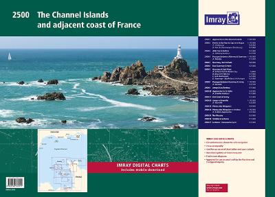


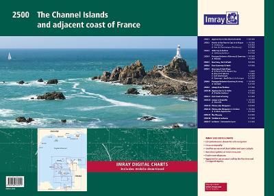
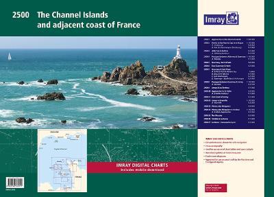
A convenient A2 format chart pack of the Channel Islands and the adjacent coast of France provided in a sturdy plastic wallet. This fully revised edition includes the latest official UKHO Digital, combined with additional information sourced from Imray's network to make it ideal for small craft. The chart pack includes all the navigational charts and tidal Digital for passage, approach and mooring. This edition has been reschemed to show passage from as far East as Saint-Vaast-la-Hougue and Barfleur. The harbour plan of Port de Chantereyne (Cherbourg) has been extended so show greater approach detail. There has been general updating throughout. This product is also available wiro bound, please use code IC2500-4W. 2500.1 Approaches to the Channel Islands 1: 500 000 WGS 84 2500.2 Pointe de Barfleur to Cap de la Hague 1: 155 000 WGS 84 Plans Cherbourg (1:40 000), Port de Chantereyne (Cherbourg) (1:10 000) 2500.3 Alderney & Burhou 1: 25 000 WGS 84 Plan Alderney Harbour (1:12 500) 2500.4 Passages Between Alderney & Guernsey 1: 150 000 WGS 84 Plan Diélette (1:15 000) 2500.5 Guernsey, Herm & Sark 1: 60 000 WGS 84 2500.6 East Guernsey & Herm 1: 25 000 WGS 84 2500.7 Guernsey & Sark Plans 1: various WGS 84 Plans St Peter Port & Havelet Bay (1:6000), Beaucette Marina (1:10 000), Sark Anchorages (1:25 000), Guernsey - South Coast Anchorages (1:25 000) 2500.8 Passages between Guernsey & Jersey 1: 150 000 WGS 84 Plan Carteret (1:22 500) 2500.9 Jersey & Les Écrehou 1: 75 000 WGS 84 2500.10 Approaches to St Helier 1: 30 000 WGS 84 Plan St Helier Harbour (1:15 000) 2500.11 East Coast of Jersey 1: 25 000 WGS 84 2500.12 Jersey to Granville 1: 150 000 WGS 84 Plan Granville (1:30 000) 2500.13 Plateau des Minquiers 1: 50 000 WGS 84 2500.14 Plateau des Minquiers to St-Malo 1: 150 000 WGS 84 Plan St-Malo Approaches (1:55 000) 2500.15 Îles Chausey 1: 25 000 WGS 84 2500.16 St-Malo & La Rance 1: 15 000 WGS 84 2500.17 La Rance - Cancaval to Lyvet 1: 25 000 WGS 84 A voucher code to download ID20 Imray English Channel charts into Imray Navigator (our app for iPad, iPhone and Android) is included with this chart pack.
-
Autore:
-
Editore:
-
Anno:2022
-
Rilegatura:Sheet map, flat
-
Pagine:15 p.
Testo in English
Dimensioni:
594 x 420 mm
Peso:
660 gr.
EAN:
9781786793911

Informazioni e Contatti sulla Sicurezza dei Prodotti
Le schede prodotto sono aggiornate in conformità al Regolamento UE 988/2023. Laddove ci fossero taluni dati non disponibili per ragioni indipendenti da Feltrinelli, vi informiamo che stiamo compiendo ogni ragionevole sforzo per inserirli. Vi invitiamo a controllare periodicamente il sito www.lafeltrinelli.it per eventuali novità e aggiornamenti.
Per le vendite di prodotti da terze parti, ciascun venditore si assume la piena e diretta responsabilità per la commercializzazione del prodotto e per la sua conformità al Regolamento UE 988/2023, nonché alle normative nazionali ed europee vigenti.
Per informazioni sulla sicurezza dei prodotti, contattare productsafety@feltrinelli.it
