










LIBRO INGLESE





Berlin Intelligence Map

6,19 €
+60
punti 
Venditore: Feltrinelli
Articolo acquistabile con Carta del Docente

Articolo acquistabile con Carta Cultura Giovani e Carta del Merito

Articolo acquistabile con Carta della Cultura

Dati e Statistiche
 Salvato in 0 liste dei desideri
Salvato in 0 liste dei desideri
Berlin Intelligence Map
Attualmente non disponibile
6,19 €
6,19 €
Attualmente non disponibile
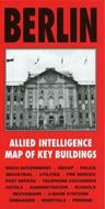




Published specially by After the Battle to coincide with the suspension of Allied occupation rights in Berlin in October 1990, this map was produced in 1944 by the War Office and lists the location and use of all important buildings in Berlin to be used in the occupation of the city. Every building associated with the Reich Government, NSDAP, police, fire service, Reichsbahn, U-Bahn, hospitals, telephone exchanges, embassies, prisons, etc., is numbered and referenced to an index printed on the reverse of the map. This sheet covers the central area at 1:12500.
-
Editore:
-
Anno:2001
-
Rilegatura:Sheet map, flat
Testo in English
Dimensioni:
297 x 152 mm
EAN:
9781870067331

Informazioni e Contatti sulla Sicurezza dei Prodotti
Le schede prodotto sono aggiornate in conformità al Regolamento UE 988/2023. Laddove ci fossero taluni dati non disponibili per ragioni indipendenti da Feltrinelli, vi informiamo che stiamo compiendo ogni ragionevole sforzo per inserirli. Vi invitiamo a controllare periodicamente il sito www.lafeltrinelli.it per eventuali novità e aggiornamenti.
Per le vendite di prodotti da terze parti, ciascun venditore si assume la piena e diretta responsabilità per la commercializzazione del prodotto e per la sua conformità al Regolamento UE 988/2023, nonché alle normative nazionali ed europee vigenti.
Per informazioni sulla sicurezza dei prodotti, contattare productsafety@feltrinelli.it
