LIBRO INGLESE
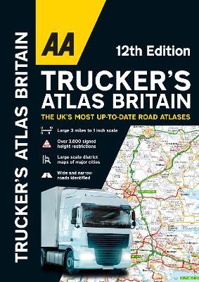
AA Trucker's Atlas Britain
22,49 €
+220
punti 
Venditore: Feltrinelli
Articolo acquistabile con Carta del Docente

Articolo acquistabile con Carta Cultura Giovani e Carta del Merito

Articolo acquistabile con Carta della Cultura

Dati e Statistiche
 Salvato in 0 liste dei desideri
AA Trucker's Atlas Britain
Disponibile in 5 gg lavorativi
22,49 €
22,49 €
Disponibile in 5 gg lavorativi


Fully updated for 2024, the atlas includes truck and freight ferry routes and port plans, route planner map, quick reference distance chart and an explanatory list of restricted motorway junctions. Additionally there is a 12-page section of London street mapping with height, width and weight restrictions clearly marked, as well as large scale district maps of London, Birmingham, Glasgow, Manchester and Tyne & Wear. Information of particular importance to truck drivers is emphasised on the mapping which includes over 3,600 bridge heights, with the most frequently struck rail bridges highlighted. Roads less than 4 metres wide are distinguished, as well as road tunnels, toll roads, service areas, steep gradients, level crossings and low emission zones. A special feature, in conjunction with Network Rail’s campaign, provides useful information on prevention of bridge strikes - an essential read for all truck drivers and other professionals in the haulage industry.
-
Editore:
-
Anno:2023
-
Rilegatura:Spiral bound
-
Pagine:144 p.
Testo in English
Dimensioni:
402 x 285 mm
EAN:
9780749583583
Informazioni e Contatti sulla Sicurezza dei Prodotti
Le schede prodotto sono aggiornate in conformità al Regolamento UE 988/2023. Laddove ci fossero taluni dati non disponibili per ragioni indipendenti da Feltrinelli, vi informiamo che stiamo compiendo ogni ragionevole sforzo per inserirli. Vi invitiamo a controllare periodicamente il sito www.lafeltrinelli.it per eventuali novità e aggiornamenti.
Per le vendite di prodotti da terze parti, ciascun venditore si assume la piena e diretta responsabilità per la commercializzazione del prodotto e per la sua conformità al Regolamento UE 988/2023, nonché alle normative nazionali ed europee vigenti.
Per informazioni sulla sicurezza dei prodotti, contattare productsafety@feltrinelli.it