
LIBRO INGLESE
Ben Nevis: Mamores & Grey Corries
19,94 €
+200
punti 
Venditore: Feltrinelli
Articolo acquistabile con Carta del Docente

Articolo acquistabile con Carta Cultura Giovani e Carta del Merito

Articolo acquistabile con Carta della Cultura

Dati e Statistiche
 Salvato in 0 liste dei desideri
Ben Nevis: Mamores & Grey Corries
Disponibile in 5 gg lavorativi
19,94 €
19,94 €
Disponibile in 5 gg lavorativi

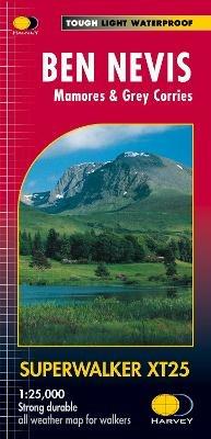
Ben Nevis with the Mamores and Grey Corries ranges at 1:25,000 on a double-sided, waterproof and tear-resistant map from Harvey Map Services in their Superwalker series, with the peak area also shown in greater detail at 1:12,500. The map divides the area north/south, with a good overlap between the sides, extending from Fort William past Loch Treig to Chno Deang, plus south to Loch Leven and the Blackwater Reservoir. The enlargement highlights the bad visibility descent route including instructions. The main map at 25K also highlights recommended mountain bike trails.
-
Autore:
-
Editore:
-
Collana:Superwalker XT25
-
Anno:2017
-
Rilegatura:Sheet map, folded
Testo in English
Dimensioni:
243 x 116 mm
Peso:
56 gr.
EAN:
9781851374021
Informazioni e Contatti sulla Sicurezza dei Prodotti
Le schede prodotto sono aggiornate in conformità al Regolamento UE 988/2023. Laddove ci fossero taluni dati non disponibili per ragioni indipendenti da Feltrinelli, vi informiamo che stiamo compiendo ogni ragionevole sforzo per inserirli. Vi invitiamo a controllare periodicamente il sito www.lafeltrinelli.it per eventuali novità e aggiornamenti.
Per le vendite di prodotti da terze parti, ciascun venditore si assume la piena e diretta responsabilità per la commercializzazione del prodotto e per la sua conformità al Regolamento UE 988/2023, nonché alle normative nazionali ed europee vigenti.
Per informazioni sulla sicurezza dei prodotti, contattare productsafety@feltrinelli.it