









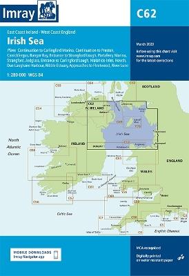
LIBRO INGLESE





C62 Irish Sea


36,19 €
+360
punti 
Venditore: Feltrinelli
Articolo acquistabile con Carta del Docente

Articolo acquistabile con Carta Cultura Giovani e Carta del Merito

Articolo acquistabile con Carta della Cultura

Dati e Statistiche
 Salvato in 0 liste dei desideri
Salvato in 0 liste dei desideri
C62 Irish Sea
Disponibile in 5 gg lavorativi
36,19 €
36,19 €
Disponibile in 5 gg lavorativi
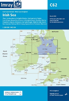


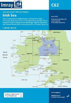
Plans included: Carrickfergus (1:15 000) Bangor Bay (1:17 500) Entrance to Strangford Lough (1:37 500) Portaferry Marina (1:7500) Strangford (1:5000) Ardglass (1:15 000) Entrance to Carlingford Lough (1:26 000) Malahide Inlet (1:35 000) Howth (1:12 500) Dun Laoghaire Harbour (1:15 000) Ribble Estuary (1:125 000) Approaches to Fleetwood (1:50 000) River Lune (1:100 000) Continuation to Carlingford Marina (1:40 000) Continuation to Preston (1:125 000) On this edition the chart specification has been improved to show coloured light flashes. Updated bathymetric Digital has been included where available. The firing practice areas have been updated. There has been general updating throughout.
-
Autore:
-
Editore:
-
Anno:2024
-
Rilegatura:Sheet map, folded
-
Pagine:2 p.
Testo in English
Dimensioni:
297 x 210 mm
Peso:
240 gr.
EAN:
9781786791917

Informazioni e Contatti sulla Sicurezza dei Prodotti
Le schede prodotto sono aggiornate in conformità al Regolamento UE 988/2023. Laddove ci fossero taluni dati non disponibili per ragioni indipendenti da Feltrinelli, vi informiamo che stiamo compiendo ogni ragionevole sforzo per inserirli. Vi invitiamo a controllare periodicamente il sito www.lafeltrinelli.it per eventuali novità e aggiornamenti.
Per le vendite di prodotti da terze parti, ciascun venditore si assume la piena e diretta responsabilità per la commercializzazione del prodotto e per la sua conformità al Regolamento UE 988/2023, nonché alle normative nazionali ed europee vigenti.
Per informazioni sulla sicurezza dei prodotti, contattare productsafety@feltrinelli.it
