
LIBRO INGLESE
Hadrian's Wall Path: With Ordnance Survey Mapping
14,99 €
+150
punti 
Venditore: Feltrinelli
Articolo acquistabile con Carta del Docente

Articolo acquistabile con Carta Cultura Giovani e Carta del Merito

Articolo acquistabile con Carta della Cultura

Dati e Statistiche
 Salvato in 0 liste dei desideri
Hadrian's Wall Path: With Ordnance Survey Mapping
Disponibile in 5 gg lavorativi
14,99 €
14,99 €
Disponibile in 5 gg lavorativi

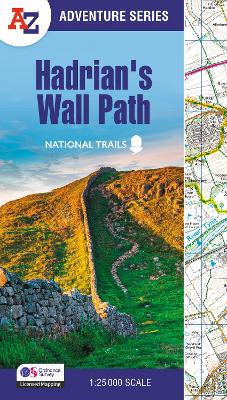

The A-Z Adventure Series of maps combines the best of OS and A-Z, creating the perfect companion for walkers, off-road cyclists, horse riders and anyone wishing to explore the great outdoors. Hadrian's Wall Path is a National Trail which follows the line of Hadrian's Wall from coast-to-coast. The 84 mile (135km) path weaves through beautiful countryside, encountering historic remains of Roman forts and milecastles, splendid bridges, views from the Whin Sill escarpment and Solway salt marshes. Starting in Wallsend in Newcastle and ending in Bowness-on-Solway, the route on the map is clearly highlighted in yellow with mileage markers added to gauge distances when planning sections of the walk to enjoy. This National Trail Map of Hadrian's Wall Path features 38 pages of continuous Ordnance Survey 1:25 000 mapping, providing complete coverage of the Hadrian's Wall Path. The atlas includes a route planner showing distances between places and the amenities available, featuring: •Information Centres •Hotels/B&Bs •Youth Hostels •Campsites (seasonal opening) •Pubs, shops, restaurants, and cafes (seasonal opening) •Petrol Stations Also featured is advice on safety and security when walking and the Countryside Code. Unlike the original OS sheets, this A-Z Adventure Atlas includes a comprehensive index to towns, villages, hamlets and locations, natural features, nature reserves, car parks and youth hostels, making it easy to find the required location quickly. Each index entry has a page reference and a six figure National Grid Reference. With a book size of 240mm x 134mm it is the same size as the standard folded OS map. Other National Trails available within the A-Z Adventure series include: Cotswold Way, Pembrokeshire Coast Path, South Downs Way, SW Coast Path, and Thames Path.
-
Autore:
-
Editore:
-
Collana:A -Z Adventure Series
-
Anno:2026
-
Rilegatura:Paperback / softback
-
Pagine:56 p.
Testo in English
Dimensioni:
240 x 134 mm
Peso:
110 gr.
EAN:
9780008780531
Informazioni e Contatti sulla Sicurezza dei Prodotti
Le schede prodotto sono aggiornate in conformità al Regolamento UE 988/2023. Laddove ci fossero taluni dati non disponibili per ragioni indipendenti da Feltrinelli, vi informiamo che stiamo compiendo ogni ragionevole sforzo per inserirli. Vi invitiamo a controllare periodicamente il sito www.lafeltrinelli.it per eventuali novità e aggiornamenti.
Per le vendite di prodotti da terze parti, ciascun venditore si assume la piena e diretta responsabilità per la commercializzazione del prodotto e per la sua conformità al Regolamento UE 988/2023, nonché alle normative nazionali ed europee vigenti.
Per informazioni sulla sicurezza dei prodotti, contattare productsafety@feltrinelli.it