
LIBRO INGLESE
Imray Chart B32: Carriacou to Grenada
29,94 €
+300
punti 
Venditore: Feltrinelli
Articolo acquistabile con Carta del Docente

Articolo acquistabile con Carta Cultura Giovani e Carta del Merito

Articolo acquistabile con Carta della Cultura

Dati e Statistiche
 Salvato in 0 liste dei desideri
Imray Chart B32: Carriacou to Grenada
Disponibile in 5 gg lavorativi
29,94 €
29,94 €
Disponibile in 5 gg lavorativi

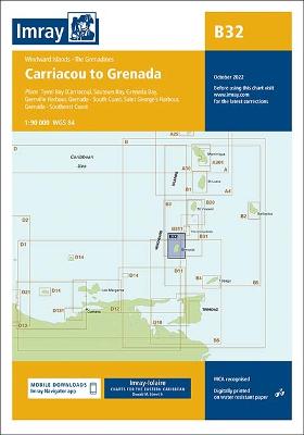

Imray-Iolaire charts for Caribbean are widely acknowledged as the best available for the cruising sailor. They combine the latest official survey data with first-hand information gathered over 60 years of research by Don Street Jr and his wide network of contributors. Like all Imray charts, they are printed on water resistant Pretex paper for durability, and they include many anchorages, facilities and inlets not included on official charts. Plans included: Tyrrel Bay (Carriacou) (1:17 500) Grenada Bay (1:30 000) Grenville Harbour (1:15 000) Grenada - Southeast Coast (1:45 000) Grenada - South Coast (1:40 000) Saint George's Harbour (1:12 500) On this edition, a new large scale plan of the South East coast of Grenada is included covering Great Bacolet Point to Marquis Point. New ranges and recommended courses are included and existing ones have been updated. The chart specification has been improved to show coloured light flashes. There has been general updating throughout.
-
Autore:
-
Editore:
-
Collana:Lolaire
-
Anno:2022
-
Rilegatura:Paperback / softback
Pagine:
1 p.
Testo in English
Dimensioni:
295 x 210 mm
EAN:
9781786794161
Informazioni e Contatti sulla Sicurezza dei Prodotti
Le schede prodotto sono aggiornate in conformità al Regolamento UE 988/2023. Laddove ci fossero taluni dati non disponibili per ragioni indipendenti da Feltrinelli, vi informiamo che stiamo compiendo ogni ragionevole sforzo per inserirli. Vi invitiamo a controllare periodicamente il sito www.lafeltrinelli.it per eventuali novità e aggiornamenti.
Per le vendite di prodotti da terze parti, ciascun venditore si assume la piena e diretta responsabilità per la commercializzazione del prodotto e per la sua conformità al Regolamento UE 988/2023, nonché alle normative nazionali ed europee vigenti.
Per informazioni sulla sicurezza dei prodotti, contattare productsafety@feltrinelli.it