
LIBRO INGLESE
Pembrokeshire Coast Path Map Guide: 1:25,000 scales Ordnance Survey mapping for the Pembrokeshire section of the Wales Coast Path
12,49 €
+120
punti 
Venditore: Feltrinelli
Articolo acquistabile con Carta del Docente

Articolo acquistabile con Carta Cultura Giovani e Carta del Merito

Articolo acquistabile con Carta della Cultura

Dati e Statistiche
 Salvato in 0 liste dei desideri
Pembrokeshire Coast Path Map Guide: 1:25,000 scales Ordnance Survey mapping for the Pembrokeshire section of the Wales Coast Path
Disponibile in 5 gg lavorativi
12,49 €
12,49 €
Disponibile in 5 gg lavorativi

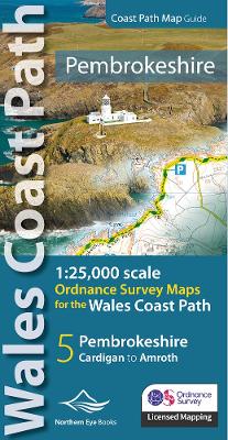

One of seven handy, lightweight, pocket size map books covering the whole of the 870-mile/1400 kilometre Wales Coast Path - from Chester to Chepstow. Each map book matches one of the seven sections covered by the Official Guidebooks. . Sections include: 1: North Wales Coast, 2: Isle of Anglesey, 3: Llyn Peninsula, 4: Snowdonia & Ceredigion Coast, 5: Pembrokeshire, 6: Carmarthen Bay & Gower, and 7: South Wales Coast. - Large scale OS mapping for the complete coast of Pembrokeshire in a handy atlas format. (Also covers the entire Pembrokeshire Coastal Path) - Highlighted official route of the Wales Coast Path - On-map symbols showing amenities at main towns and villages - Introduction with attractive photo mosaic - Additional useful information
-
Editore:
-
Collana:OS Map Books: Wales Coast Path
-
Anno:2023
-
Rilegatura:Paperback / softback
Pagine:
48 p.
Testo in English
Dimensioni:
215 x 109 mm
EAN:
9781908632623
Informazioni e Contatti sulla Sicurezza dei Prodotti
Le schede prodotto sono aggiornate in conformità al Regolamento UE 988/2023. Laddove ci fossero taluni dati non disponibili per ragioni indipendenti da Feltrinelli, vi informiamo che stiamo compiendo ogni ragionevole sforzo per inserirli. Vi invitiamo a controllare periodicamente il sito www.lafeltrinelli.it per eventuali novità e aggiornamenti.
Per le vendite di prodotti da terze parti, ciascun venditore si assume la piena e diretta responsabilità per la commercializzazione del prodotto e per la sua conformità al Regolamento UE 988/2023, nonché alle normative nazionali ed europee vigenti.
Per informazioni sulla sicurezza dei prodotti, contattare productsafety@feltrinelli.it