
LIBRO INGLESE
Rand McNally Easy to Read: Nebraska State Map
9,91 €

-5%
10,43 €
+100
punti Prezzo minimo ultimi 30 giorni: 9,79 €
Venditore: Feltrinelli
Articolo acquistabile con Carta del Docente

Articolo acquistabile con Carta Cultura Giovani e Carta del Merito

Articolo acquistabile con Carta della Cultura

Dati e Statistiche
 Salvato in 0 liste dei desideri
Rand McNally Easy to Read: Nebraska State Map
Disponibilità in 3 settimane
9,91 €
-5%
10,43 €
9,91 €
10,43 €
-5%
Disponibilità in 3 settimane


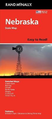
Rand McNally's Easy To Read State Folded Map is a must-have for anyone traveling in and around Nebraska, offering unbeatable accuracy and reliability at a great price. Our trusted cartography shows all Interstate, U.S., state, and county highways, along with clearly indicated parks, points of interest, airports, county boundaries, and streets. The easy-to-use legend and detailed index make for quick and easy location of destinations. You'll see why Rand McNally folded maps have been the trusted standard for years. - Regularly updated, full-color maps. - 47% larger map with a bigger type size than the Rand McNally Folded Map. - Clearly labeled Interstate, U.S., state, and county highways. - Indications of parks, points of interest, airports, county boundaries, and more. - Mileage and driving times map. - Detailed index. - Convenient folded size. Coverage Area Detailed maps of: Grand Island, Lincoln, North Platte, Omaha, Scottsbluff, South Sioux City/Sioux City, IA. Product Details: Dimensions (unfolded): 28 x 40.
-
Autore:
-
Editore:
-
Anno:2025
-
Rilegatura:Sheet map, folded
Testo in English
EAN:
9780528029004
Informazioni e Contatti sulla Sicurezza dei Prodotti
Le schede prodotto sono aggiornate in conformità al Regolamento UE 988/2023. Laddove ci fossero taluni dati non disponibili per ragioni indipendenti da Feltrinelli, vi informiamo che stiamo compiendo ogni ragionevole sforzo per inserirli. Vi invitiamo a controllare periodicamente il sito www.lafeltrinelli.it per eventuali novità e aggiornamenti.
Per le vendite di prodotti da terze parti, ciascun venditore si assume la piena e diretta responsabilità per la commercializzazione del prodotto e per la sua conformità al Regolamento UE 988/2023, nonché alle normative nazionali ed europee vigenti.
Per informazioni sulla sicurezza dei prodotti, contattare productsafety@feltrinelli.it