
LIBRO INGLESE
Thames Path
20,63 €
+210
punti 
Venditore: Feltrinelli
Articolo acquistabile con Carta del Docente

Articolo acquistabile con Carta Cultura Giovani e Carta del Merito

Articolo acquistabile con Carta della Cultura

Dati e Statistiche
 Salvato in 0 liste dei desideri
Thames Path
Disponibile in 5 gg lavorativi
20,63 €
20,63 €
Disponibile in 5 gg lavorativi

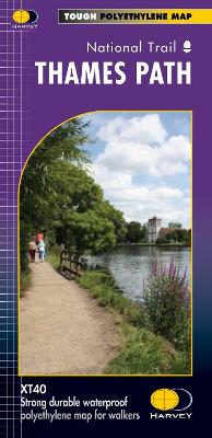

The Thames Path follows the banks of the river for 184 miles (294km) from the flood barrier at Woolwich in South East London to Kemble Gloucestershire. It is a long distance walking route, most of it cannot be cycled. The Trail passes through water meadows, historic towns and lovely villages. The path is flat which makes for easy walking. Jos Joslin National Trails Manager (Marketing & Projects) said of this map, Really beneficial to have the whole length of the Thames Path upstream of London on just one map. Clear mapping and useful information makes this this a very practical map. This map is printed on 100% waterproof paper which is light, durable and tearproof.
-
Autore:
-
Editore:
-
Collana:Trail Map XT60
-
Anno:2017
-
Rilegatura:Sheet map, folded
-
Pagine:1 p.
Testo in English
Dimensioni:
245 x 115 mm
Peso:
54 gr.
EAN:
9781851375127
Informazioni e Contatti sulla Sicurezza dei Prodotti
Le schede prodotto sono aggiornate in conformità al Regolamento UE 988/2023. Laddove ci fossero taluni dati non disponibili per ragioni indipendenti da Feltrinelli, vi informiamo che stiamo compiendo ogni ragionevole sforzo per inserirli. Vi invitiamo a controllare periodicamente il sito www.lafeltrinelli.it per eventuali novità e aggiornamenti.
Per le vendite di prodotti da terze parti, ciascun venditore si assume la piena e diretta responsabilità per la commercializzazione del prodotto e per la sua conformità al Regolamento UE 988/2023, nonché alle normative nazionali ed europee vigenti.
Per informazioni sulla sicurezza dei prodotti, contattare productsafety@feltrinelli.it