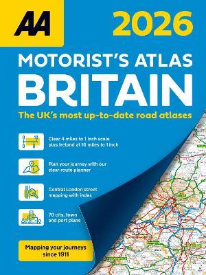
AA Motorist's Atlas 2026
This A4 format spiral bound road atlas provides super-clear mapping at 4 miles to 1 inch. Fully updated mapping with 70 city, town and port plans, top 300 AA-Inspected caravan and camping sites, district mapping of Birmingham, Glasgow, Manchester, London and Newcastle. Each page has been titled with its geographical location so you can turn to the page you need more easily. Wide minor roads (more than and less than 4m wide), National Trust, English and World Heritage sites, crematorium locations and other hard-to-find places are also shown. Including 70 city, town and port plans and 10 pages of central London mapping with index. A comprehensive 31,500 entry index with airports, top tourist sites and motorway services listed. The ferry port plans are inset on the mapping for ease of reference. Scenic routes, tourist sites and caravan and camping sites are symbolised on the mapping.
-
Editore:
-
Anno:2025
-
Rilegatura:Spiral bound
-
Pagine:208 p.
Le schede prodotto sono aggiornate in conformità al Regolamento UE 988/2023. Laddove ci fossero taluni dati non disponibili per ragioni indipendenti da Feltrinelli, vi informiamo che stiamo compiendo ogni ragionevole sforzo per inserirli. Vi invitiamo a controllare periodicamente il sito www.lafeltrinelli.it per eventuali novità e aggiornamenti.
Per le vendite di prodotti da terze parti, ciascun venditore si assume la piena e diretta responsabilità per la commercializzazione del prodotto e per la sua conformità al Regolamento UE 988/2023, nonché alle normative nazionali ed europee vigenti.
Per informazioni sulla sicurezza dei prodotti, contattare productsafety@feltrinelli.it


