

LIBRO INGLESE
Collins Road Map of France
9,99 €
+100
punti 
Venditore: Feltrinelli
Articolo acquistabile con Carta del Docente

Articolo acquistabile con Carta Cultura Giovani e Carta del Merito

Dati e Statistiche
 Salvato in 0 liste dei desideri
Collins Road Map of France
Disponibilità in 5 gg lavorativi
9,99 €
9,99 €
Disponibilità in 5 gg lavorativi


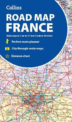
Discover new places in France with easy-to-read mapping from Collins. A fully revised and updated colour road map of France at 18 miles to 1 inch / 11km to 1cm (1:1,120,000). The map shows individual department by name. All cities, towns, roads, European route numbers, motorways and toll motorways are clearly shown, making it the ideal map for planning and route-finding. The map shows the road network in detail for easy route planning. With its political colouring of departments, it is ideal for reference and business users also. This map includes: • Fully revised and updated Clear, detailed road network Distance chart giving distances in kilometres between main towns Key to department names and numbers, and list of regions Internet links to further information Full Index to place names Map key in English, French and German Area of coverage: Covers the whole of France from the Belgian and German borders in the north to the Spanish border in the south, and from the Brest Peninsula in the west to the Italian and Swiss borders in the east. Also includes the island of Corsica.
-
Autore:
-
Editore:
-
Anno:2025
-
Rilegatura:Sheet map, folded
-
Pagine:2 p.
Testo in English
Dimensioni:
226 x 125 mm
Peso:
100 gr.
EAN:
9780008716486
Informazioni e Contatti sulla Sicurezza dei Prodotti
Le schede prodotto sono aggiornate in conformità al Regolamento UE 988/2023. Laddove ci fossero taluni dati non disponibili per ragioni indipendenti da Feltrinelli, vi informiamo che stiamo compiendo ogni ragionevole sforzo per inserirli. Vi invitiamo a controllare periodicamente il sito www.lafeltrinelli.it per eventuali novità e aggiornamenti.
Per le vendite di prodotti da terze parti, ciascun venditore si assume la piena e diretta responsabilità per la commercializzazione del prodotto e per la sua conformità al Regolamento UE 988/2023, nonché alle normative nazionali ed europee vigenti.
Per informazioni sulla sicurezza dei prodotti, contattare productsafety@feltrinelli.it