
LIBRO INGLESE
Imray Chart C15 The Solent: Bembridge to Hurst Point and Southampton
36,19 €
+360
punti 
Venditore: Feltrinelli
Articolo acquistabile con Carta del Docente

Articolo acquistabile con Carta Cultura Giovani e Carta del Merito

Articolo acquistabile con Carta della Cultura

Dati e Statistiche
 Salvato in 0 liste dei desideri
Imray Chart C15 The Solent: Bembridge to Hurst Point and Southampton
Disponibile in 5 gg lavorativi
36,19 €
36,19 €
Disponibile in 5 gg lavorativi
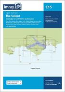

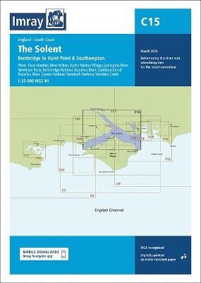
Covering one of the most popular sailing areas in Britain, The Solent chart provides all the information needed for planning and navigating this stretch of water. This edition includes the latest official data from the UKHO combined with additional information sourced from Imray's network to make it ideal for small craft. New: Vessel Traffic Services (VTS) reporting points Imray charts for the Solent and approaches now include all VTS reporting points found in these waters. VTS reporting is mandatory for vessels of more than 20m in length that are bound to and from the Solent. The latest racing buoy information is included and the chart has been fully revised throughout. Plans included: River Hamble (1:12 500) River Itchen (1:12 500) Hythe Marina Village (1:12 500) Lymington River (1:15 000) Newtown River (1:20 000) Bembridge Harbour (1:10 000) Beaulieu River (1:20 000) Continuation of Beaulieu River (1:20 000) Cowes Harbour (1:20 000) Yarmouth Harbour (1:4500) Wootton Creek (1:20 000)
-
Autore:
-
Editore:
-
Collana:C Charts
-
Anno:2024
-
Rilegatura:Sheet map, folded
Pagine:
1 p.
Testo in English
EAN:
9781786795717
Informazioni e Contatti sulla Sicurezza dei Prodotti
Le schede prodotto sono aggiornate in conformità al Regolamento UE 988/2023. Laddove ci fossero taluni dati non disponibili per ragioni indipendenti da Feltrinelli, vi informiamo che stiamo compiendo ogni ragionevole sforzo per inserirli. Vi invitiamo a controllare periodicamente il sito www.lafeltrinelli.it per eventuali novità e aggiornamenti.
Per le vendite di prodotti da terze parti, ciascun venditore si assume la piena e diretta responsabilità per la commercializzazione del prodotto e per la sua conformità al Regolamento UE 988/2023, nonché alle normative nazionali ed europee vigenti.
Per informazioni sulla sicurezza dei prodotti, contattare productsafety@feltrinelli.it