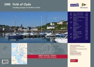
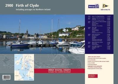
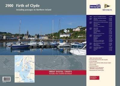
Imray Chart Pack 2900 Firth of Clyde Chart Pack: Firth of Clyde Includes passages to Northern Ireland
This complete redesign of our 2900 Firth of Clyde chart pack now include more detailed coverage of the area and comes as a paper and digital edition. Created in association with the Clyde Cruising Club for use alongside their sailing directions, coverage includes detail of this delightful area of Scotland with passages to Northern Ireland and references to the popular large scale Antares Charts. The 16 sheets in this pack provide all the necessary information for passage planning, detailed approach to yacht havens and marinas, and the numerous anchorages and sailing areas recommended for small craft. Coverage includes the Firth of Clyde, lochs to the north of the Upper Clyde, the Kyles of Bute and Loch Fyne, and Kilbrannan Sound to the Mull of Kintyre. This expanded edition also includes coverage of the North Channel, detailing passage from the Firth of Clyde and Loch Ryan to Belfast Lough. Charts included: 1. Firth of Clyde (1:210 000) 2. The North Channel (1:210 000) 3. Aisla Craig to Ayr (1:75 000) includes plans Girvan (1:6000), Ayr (1:10 000) 4. Ayr to Ardrossan (1:75 000) includes plans Troon (1:12 500), Irvine (1:17 500), Ardrossan (1:10 000) 5. Pladda to Lamlash Harbour (1:30 000) 6. South of Bute & the Cumbraes (1:30 000) includes plans MiIlport (1:15 000), Largs Yacht Haven (1:15 000) 7. Upper Clyde (1:50 000) includes plans Kip Marina (1:15 000), Rothesay Bay (1:10 000), Rothesay Harbour (1:5000) 8. Long Loch & Gareloch (1:50 000) includes plans Continuation of Long Loch (1:50 000), Continuation of River Clyde (1:100 000), Dumbarton (1:15 000), Bowling (1:15 000), Approaches to Rhu (1:15 000), Holy Loch Marina (1:12 500) 9. Kyles of Bute (1:30 000) includes plans Continuation of Loch Striven (1:30 000), Continuation of Loch Riddon (1:30 000), Port Bannatyne Marina (1:10 000), Burnt Islands (1:10 000), Caladh Harbour (1:10 000) 10. Inchmarnock Water (1:30 000) 11. Lower Loch Fyne (1:50 000) includes plans Portavadie (1:25 000), East Loch Tarbert (1:8000), Ardrishaig (1:10 000) 12. Upper Loch Fyne (1:50 000) includes plans Continuation of Loch Fyne (1:50 000), Loch Gair (1:25 000), Minard Narrows (1:25 000), Invaray (1:25 000) 13. Inchmarnock to Kilbrannan Sound (1:50 000) includes plan Loch Ranza (1:22 500) 14. Carradale to Sanda Island (1:75 000) includes plans Campbeltown Loch (1:35 000), Campbeltown Harbour (1:7500), Sanda Island (1:30 000) 15. Aisla Craig to Loch Ryan (1:75 000) includes plan Stranraer (1:12 500) 16. Belfast Lough to Carnlough (1:90 000) includes plans Carrickfergus (1:15 000), Bangor Bay (1:17 500)
-
Autore:
-
Editore:
-
Collana:2000 series
-
Anno:2020
-
Rilegatura:Sheet map, flat
-
Pagine:16 p.
Le schede prodotto sono aggiornate in conformità al Regolamento UE 988/2023. Laddove ci fossero taluni dati non disponibili per ragioni indipendenti da Feltrinelli, vi informiamo che stiamo compiendo ogni ragionevole sforzo per inserirli. Vi invitiamo a controllare periodicamente il sito www.lafeltrinelli.it per eventuali novità e aggiornamenti.
Per le vendite di prodotti da terze parti, ciascun venditore si assume la piena e diretta responsabilità per la commercializzazione del prodotto e per la sua conformità al Regolamento UE 988/2023, nonché alle normative nazionali ed europee vigenti.
Per informazioni sulla sicurezza dei prodotti, contattare productsafety@feltrinelli.it


