
LIBRO INGLESE
Isle of Anglesey Coast Path Map: 1:25,000 scale Ordnance Survey mapping for the entire Isle of Anglesey Coast Path
12,49 €
+120
punti 
Venditore: Feltrinelli
Articolo acquistabile con Carta del Docente

Articolo acquistabile con Carta Cultura Giovani e Carta del Merito

Articolo acquistabile con Carta della Cultura

Dati e Statistiche
 Salvato in 0 liste dei desideri
Isle of Anglesey Coast Path Map: 1:25,000 scale Ordnance Survey mapping for the entire Isle of Anglesey Coast Path
Disponibile in 5 gg lavorativi
12,49 €
12,49 €
Disponibile in 5 gg lavorativi

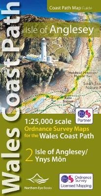
Enhanced, large scale (1: 25,000) Ordnance Survey mapping in a handy atlas format with all the mapping you need to walk a complete circuit of the Anglesey section of the Wales Coast Path. Continuous OS mapping covering the complete circuit from Menai Bridge. Contains coastal extracts from large scale Explorer maps 262 and 263. - Large scale Ordnance Survey mapping for the complete circuit of the Isle of Anglesey in a handy atlas format. - Highlighted official route of the Wales Coast Path/ Anglesey Coastal Path. - On-map symbols showing amenities at main towns and villages. - Introduction with attractive photo mosaic. - Additional useful information
-
Editore:
-
Collana:OS Map Books: Wales Coast Path
-
Anno:2019
-
Rilegatura:Pamphlet
Pagine:
48 p.
Testo in English
Dimensioni:
215 x 107 mm
EAN:
9781908632593
Informazioni e Contatti sulla Sicurezza dei Prodotti
Le schede prodotto sono aggiornate in conformità al Regolamento UE 988/2023. Laddove ci fossero taluni dati non disponibili per ragioni indipendenti da Feltrinelli, vi informiamo che stiamo compiendo ogni ragionevole sforzo per inserirli. Vi invitiamo a controllare periodicamente il sito www.lafeltrinelli.it per eventuali novità e aggiornamenti.
Per le vendite di prodotti da terze parti, ciascun venditore si assume la piena e diretta responsabilità per la commercializzazione del prodotto e per la sua conformità al Regolamento UE 988/2023, nonché alle normative nazionali ed europee vigenti.
Per informazioni sulla sicurezza dei prodotti, contattare productsafety@feltrinelli.it