Language & Reference Atlases, Gazetteers & Maps (1045)
-
Somerset Place Names
Venditore: Feltrinelli21,24 € -
Stonehenge and Avebury 1:10000 Map: Exploring the World Heritage Site
Venditore: Feltrinelli14,99 € -
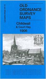
Childwall & Court Hey 1906: Lancashire Sheet 107.13
Venditore: Feltrinelli4,69 € -
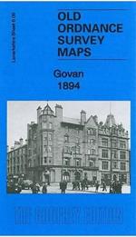
Govan 1894: Lanarkshire Sheet 06.09a
Venditore: Feltrinelli4,69 € -
Glasgow (St Rollox) 1933: Lanarkshire Sheet 6.07
Venditore: Feltrinelli4,69 € -
Welsh Place Names and Their Meanings
Venditore: Feltrinelli4,99 € -
A Landscape History of Barrow-in-Furness & South Lakeland (1852-1925) - LH3-096: Three Historical Ordnance Survey Maps
Venditore: Feltrinelli56,25 € -
Birmingham and Wolverhampton
Venditore: Feltrinelli19,99 € -
Land's End and Isles of Scilly
Venditore: Feltrinelli19,99 € -
Barefoot Books World Atlas
Venditore: Feltrinelli18,74 € -
C68 Cape Wrath to Wick and the Orkney Islands
Venditore: FeltrinelliImray, Laurie, Norie & Wilson Ltd, 2022Libri in Inglese | Language & ReferenceDisponibile in 5 gg lavorativi36,19 € -
United Nations Map of The World 1946
Venditore: Feltrinelli24,99 € -
Historical Map of London
Venditore: Feltrinelli24,99 € -
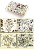
A Cheshire 1611 - 1840 - Fold Up Map that features a collection of Four Historic Maps, John Speed's County Map 1611, Johan Blaeu's County Map of 1648, Thomas Moules County Map of 1840 and Cole and Roper's Plan of the City of Chester 1805.
Venditore: Feltrinelli24,99 € -
A Middlesex 1611 - 1836 - Fold Up Map that features a collection of Four Historic Maps, John Speed's County Map 1611, Johan Blaeu's County Map of 1648, Thomas Moules County Map of 1836 and a Map of the Environs of London 1836.
Venditore: Feltrinelli24,99 € -
Manchester 1650 - 1876 - Fold Up Map featuring William Swire's Plan of Manchester and Environs 1824, Cole and Ropers Plan of Manchester and Salford 1807, Dawson's Reform Plan of 1831, A Birds Eye View of 1876 Manchester and a Plan of Manchester of 1650
Venditore: Feltrinelli24,99 € -
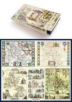
Gloucestershire 1611 - 1836 - Fold Up Map that features a collection of Four Historic Maps, John Speed's County Map 1611, Johan Blaeu's County Map of 1648, Thomas Moules County Map of 1836 and a Plan of Gloucester 1805 by Cole and Roper. The maps also feature three historic views of Gloucester from the 1840's.
Venditore: Feltrinelli24,99 € -
Devon 1611 - 1836 - Fold Up Map that features a collection of Four Historic Maps, John Speed's County Map 1611, Johan Blaeu's County Map of 1648, Thomas Moules County Map of 1836 and a Plan of Exeter 1851 by John Tallis.
Venditore: Feltrinelli24,99 € -
Liverpool 1650 to 1821 - Fold Up Map Containing Town Plans of Liverpool that include Liverpool 1650, 1725, 1795 and Sherwood's plan of Liverpool and Environs 1821
Venditore: Feltrinelli24,99 € -
A Guide to Birmingham 1924
Venditore: Feltrinelli24,99 € -
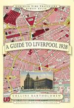
A Guide to Liverpool 1928
Venditore: Feltrinelli24,99 € -
A Oxfordshire 1611 - 1836 - Fold Up Map that features a collection of Four Historic Maps, John Speed's County Map 1611, Johan Blaeu's County Map of 1648, Thomas Moules County Map of 1836 and a Plan of Oxford 1836 by Thomas Moule. The maps also feature a number of Oxfords famous historic buildings.
Venditore: Feltrinelli24,99 € -
John Hancox's Map of the Birmingham Canal Navigations 1864
Venditore: Feltrinelli24,99 € -
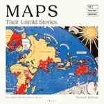
Maps: Their Untold Stories 2nd edition: Map treasures from The National Archives
Venditore: FeltrinelliBloomsbury Publishing PLC, 2025Libri in Inglese | Language & ReferenceDisponibile in 5 gg lavorativi31,25 € -
The State of the World Atlas
Venditore: FeltrinelliTaylor & Francis Ltd, 2008Libri in Inglese | Social Science, Psychology & EducationDisponibilità in 2 settimane38,60 €


Informazioni sull’ordinamento
Vengono mostrati per primi i prodotti che rispondono a questi criteri: rilevanza rispetto alla ricerca, dati di venduto, disponibilità, data di pubblicazione, tipologia di prodotto, personalizzazione ad eccezione delle sponsorizzazioni.