
LIBRO INGLESE
Offa's Dyke Map Booklet: 1:25,000 OS Route Mapping
16,19 €
+160
punti 
Venditore: Feltrinelli
Articolo acquistabile con Carta del Docente

Articolo acquistabile con Carta Cultura Giovani e Carta del Merito

Articolo acquistabile con Carta della Cultura

Dati e Statistiche
 Salvato in 0 liste dei desideri
Offa's Dyke Map Booklet: 1:25,000 OS Route Mapping
Disponibile in 5 gg lavorativi
16,19 €
16,19 €
Disponibile in 5 gg lavorativi

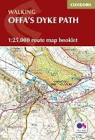

Running for 177 miles (285km) along the English–Welsh border, the Offa’s Dyke Path National Trail follows one of Britain’s most remarkable ancient monuments from Sedbury near Chepstow to Prestatyn. This rewarding long-distance trail typically takes around two weeks to complete, passing through varied landscapes including the Wye Valley, Black Mountains and Clwydian Range. The Offa’s Dyke Map Booklet is a compact, lightweight walking map and trail navigation companion featuring the entire route on detailed Ordnance Survey 1:25,000 mapping. Designed for use on the move, it provides clear, reliable navigation in a convenient pocket-sized format. Full Offa’s Dyke Path route shown on Ordnance Survey 1:25,000 mapping for precise navigation from Sedbury to Prestatyn Clearly marked trail line along the English–Welsh border, including key sections through the Wye Valley, Black Mountains and Clwydian Range Continuous mapping across the entire trail in a compact booklet, eliminating the need for multiple separate map sheets Lightweight, pocket-sized design for easy access on remote hill paths, farmland and upland ridges For step-by-step route descriptions and planning advice, the accompanying Cicerone guidebook Offa’s Dyke Path is also available From rugged uplands to peaceful valleys, the Offa’s Dyke Map Booklet helps you follow one of Britain’s most historic routes with ease, letting the scenery, history, and quiet charm of the borderlands take centre stage.
-
Editore:
-
Anno:2023
-
Rilegatura:Paperback / softback
-
Pagine:80 p.
Testo in English
Dimensioni:
172 x 116 mm
Peso:
100 gr.
EAN:
9781852848941
Informazioni e Contatti sulla Sicurezza dei Prodotti
Le schede prodotto sono aggiornate in conformità al Regolamento UE 988/2023. Laddove ci fossero taluni dati non disponibili per ragioni indipendenti da Feltrinelli, vi informiamo che stiamo compiendo ogni ragionevole sforzo per inserirli. Vi invitiamo a controllare periodicamente il sito www.lafeltrinelli.it per eventuali novità e aggiornamenti.
Per le vendite di prodotti da terze parti, ciascun venditore si assume la piena e diretta responsabilità per la commercializzazione del prodotto e per la sua conformità al Regolamento UE 988/2023, nonché alle normative nazionali ed europee vigenti.
Per informazioni sulla sicurezza dei prodotti, contattare productsafety@feltrinelli.it