
LIBRO INGLESE
Imray Chart C3: Isle of Wight
28,69 €
+290
punti 
Venditore: Feltrinelli
Articolo acquistabile con Carta del Docente

Articolo acquistabile con Carta Cultura Giovani e Carta del Merito

Dati e Statistiche
 Salvato in 0 liste dei desideri
Imray Chart C3: Isle of Wight
Disponibilità in 5 giorni lavorativi
28,69 €
28,69 €
Disp. in 5 gg lavorativi
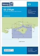

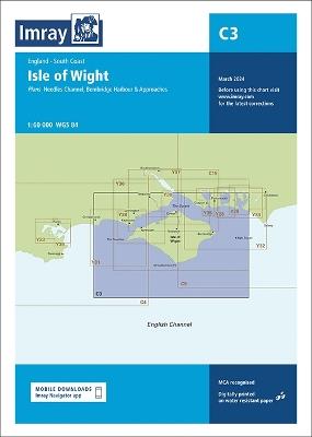
Coverage has been adjusted to show the full circumnavigation of the Isle of Wight including the south coast passage. Inset plans of the Needles Channel and Bembridge Harbour and approaches are included. The latest official UKHO data is combined with additional information sourced from Imray's network to make it ideal for small craft. New: Vessel Traffic Services (VTS) reporting points Imray charts for the Solent and approaches now include all VTS reporting points found in these waters. VTS reporting is mandatory for vessels of more than 20m in length that are bound to and from the Solent. Plans included: Needles Channel (1:35 000) Bembridge Harbour & Approaches (1:10 000) The chart is designed to be used alongside C15 The Solent for combined coastal navigation, approach, and harbour detail in and around the Solent and Isle of Wight.
-
Autore:
-
Editore:
-
Collana:C Charts
-
Anno:2024
-
Rilegatura:Sheet map, folded
Pagine:
1 p.
Testo in English
EAN:
9781786795670
Informazioni e Contatti sulla Sicurezza dei Prodotti
Le schede prodotto sono aggiornate in conformità al Regolamento UE 988/2023. Laddove ci fossero taluni dati non disponibili per ragioni indipendenti da Feltrinelli, vi informiamo che stiamo compiendo ogni ragionevole sforzo per inserirli. Vi invitiamo a controllare periodicamente il sito www.lafeltrinelli.it per eventuali novità e aggiornamenti.
Per le vendite di prodotti da terze parti, ciascun venditore si assume la piena e diretta responsabilità per la commercializzazione del prodotto e per la sua conformità al Regolamento UE 988/2023, nonché alle normative nazionali ed europee vigenti.
Per informazioni sulla sicurezza dei prodotti, contattare productsafety@feltrinelli.it