
LIBRO INGLESE
Salzburg Road and Leisure Map: 1:150,000 scale
16,13 €
+160
punti 
Venditore: Feltrinelli
Articolo acquistabile con Carta del Docente

Articolo acquistabile con Carta Cultura Giovani e Carta del Merito

Dati e Statistiche
 Salvato in 0 liste dei desideri
Salzburg Road and Leisure Map: 1:150,000 scale
Disponibilità in 5 giorni lavorativi
16,13 €
16,13 €
Disp. in 5 gg lavorativi
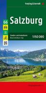


With the Salzburg road and leisure map at a scale of 1:150,000, vacationers traveling by car, motorcycle, or caravan will find their way around easily. The extensive road network is accurately depicted, and all major cycling routes, distances, and many excursion destinations are marked on the map. Information about the Salzburg road map Scale 1:150,000 Cycling routes Tourist information With info guide Campsites and pitches Place register with postcodes 9 city maps e.g. Salzburg, Radstadt, Bad Gastein approx. 122 x 87 cm Car and motorcycle drivers particularly appreciate freytag & berndt's precise cartography for planning and orientation on site. Caravan drivers and campers will, of course, find all campsites and parking spaces on the map. This map is sheet 66 of the Austria map series. The Austria map series consists of 8 sheets: Sheet 11: Lower Austria Sheet 22: Upper Austria Sheet 33: Burgenland Sheet 44: Styria Sheet 55: Carinthia Sheet 66: Salzburg Sheet 77: Tyrol Sheet 88: Vorarlberg Top Tips: The reverse of the map provides brief descriptions of the region's most important sights in German, English, French, and Italian. Printed in Austria.
-
Editore:
-
Anno:2025
-
Rilegatura:Sheet map, folded
Testo in English
EAN:
9783707923919
Informazioni e Contatti sulla Sicurezza dei Prodotti
Le schede prodotto sono aggiornate in conformità al Regolamento UE 988/2023. Laddove ci fossero taluni dati non disponibili per ragioni indipendenti da Feltrinelli, vi informiamo che stiamo compiendo ogni ragionevole sforzo per inserirli. Vi invitiamo a controllare periodicamente il sito www.lafeltrinelli.it per eventuali novità e aggiornamenti.
Per le vendite di prodotti da terze parti, ciascun venditore si assume la piena e diretta responsabilità per la commercializzazione del prodotto e per la sua conformità al Regolamento UE 988/2023, nonché alle normative nazionali ed europee vigenti.
Per informazioni sulla sicurezza dei prodotti, contattare productsafety@feltrinelli.it