LIBRO INGLESE
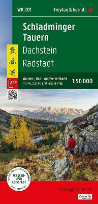
Schladminger Tauren Hiking, Cycling & Leisure Maps: Dachstein - Radstadt
16,13 €
+160
punti 
Venditore: Feltrinelli
Articolo acquistabile con Carta del Docente

Articolo acquistabile con Carta Cultura Giovani e Carta del Merito

Dati e Statistiche
 Salvato in 0 liste dei desideri
Schladminger Tauren Hiking, Cycling & Leisure Maps: Dachstein - Radstadt
Disponibilità in 5 giorni lavorativi
16,13 €
16,13 €
Disp. in 5 gg lavorativi


The Schladming Tauern Hiking, Cycling, and Leisure Map is the ideal map for hikes, bike tours, and excursions in the region. With this hiking and cycling map, you can plan your tours and find out about sights and viewpoints along the route. For winter sports enthusiasts, the map offers ski routes, cross-country ski trails and all cable cars and lifts. Information about the Schladminger Tauern hiking and cycling map Scale 1:50,000 Hiking and long-distance trails Cycle paths and mountain bike tours Ski routes and cross-country ski trails Tourist information Rother App Waterproof and tear-resistant approx. 82 x 68 cm, double-sided Rother App The linked free version of the Rother App offers a digital map with the complete hiking and cycling trail network, as well as some sample tours in the region (free registration required). Waterproof and tear-resistant So that the hiking map can be used for orientation even on rainy days, it is printed on a special waterproof and durable paper. Resource-efficient production . The card is made of 80% ground limestone. Production is significantly more resource-efficient than conventional paper, as water, wood, and energy consumption are significantly lower. Printed in Austria.
-
Editore:
-
Anno:2025
-
Rilegatura:Sheet map, folded
Testo in English
EAN:
9783707924312
Informazioni e Contatti sulla Sicurezza dei Prodotti
Le schede prodotto sono aggiornate in conformità al Regolamento UE 988/2023. Laddove ci fossero taluni dati non disponibili per ragioni indipendenti da Feltrinelli, vi informiamo che stiamo compiendo ogni ragionevole sforzo per inserirli. Vi invitiamo a controllare periodicamente il sito www.lafeltrinelli.it per eventuali novità e aggiornamenti.
Per le vendite di prodotti da terze parti, ciascun venditore si assume la piena e diretta responsabilità per la commercializzazione del prodotto e per la sua conformità al Regolamento UE 988/2023, nonché alle normative nazionali ed europee vigenti.
Per informazioni sulla sicurezza dei prodotti, contattare productsafety@feltrinelli.it