Libri Historical Images Ltd
Tutti i risultati (19)
-
Coventry City Police: A Brief History
Venditore: Feltrinelli24,99 € -
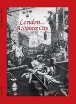
London - A Sinister City
Venditore: Feltrinelli24,99 € -
Birmingham The SinisterSide
Venditore: Feltrinelli24,99 € -
Peaky Blinders Fold Up Street Map of Birmingham 1892 - All Streets Roads and Avenues fully indexed to location grids - Map is surrounded by 22 real life character's that were labelled as "Peaky Blinders" including those who were later members of Billy Kimber's notorious Birmingham gang.: The Real Peaky Blinders of Birmingham
Venditore: Feltrinelli24,99 € -
United Nations Map of The World 1946
Venditore: Feltrinelli24,99 € -
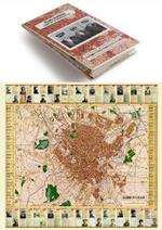
Historical Map of London
Venditore: Feltrinelli24,99 € -
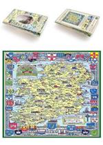
Historical Map of Ireland
Venditore: Feltrinelli24,99 € -
A Cheshire 1611 - 1840 - Fold Up Map that features a collection of Four Historic Maps, John Speed's County Map 1611, Johan Blaeu's County Map of 1648, Thomas Moules County Map of 1840 and Cole and Roper's Plan of the City of Chester 1805.
Venditore: Feltrinelli24,99 € -
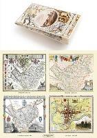
A Middlesex 1611 - 1836 - Fold Up Map that features a collection of Four Historic Maps, John Speed's County Map 1611, Johan Blaeu's County Map of 1648, Thomas Moules County Map of 1836 and a Map of the Environs of London 1836.
Venditore: Feltrinelli24,99 € -
Manchester 1650 - 1876 - Fold Up Map featuring William Swire's Plan of Manchester and Environs 1824, Cole and Ropers Plan of Manchester and Salford 1807, Dawson's Reform Plan of 1831, A Birds Eye View of 1876 Manchester and a Plan of Manchester of 1650
Venditore: Feltrinelli24,99 € -
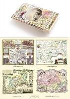
Gloucestershire 1611 - 1836 - Fold Up Map that features a collection of Four Historic Maps, John Speed's County Map 1611, Johan Blaeu's County Map of 1648, Thomas Moules County Map of 1836 and a Plan of Gloucester 1805 by Cole and Roper. The maps also feature three historic views of Gloucester from the 1840's.
Venditore: Feltrinelli24,99 € -
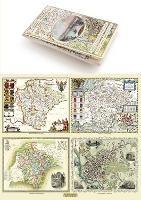
Devon 1611 - 1836 - Fold Up Map that features a collection of Four Historic Maps, John Speed's County Map 1611, Johan Blaeu's County Map of 1648, Thomas Moules County Map of 1836 and a Plan of Exeter 1851 by John Tallis.
Venditore: Feltrinelli24,99 € -
Liverpool 1650 to 1821 - Fold Up Map Containing Town Plans of Liverpool that include Liverpool 1650, 1725, 1795 and Sherwood's plan of Liverpool and Environs 1821
Venditore: Feltrinelli24,99 € -
A Guide to Birmingham 1924
Venditore: Feltrinelli24,99 € -
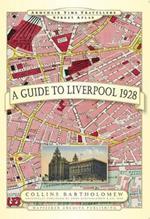
A Guide to Liverpool 1928
Venditore: Feltrinelli24,99 € -
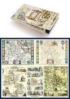
A Oxfordshire 1611 - 1836 - Fold Up Map that features a collection of Four Historic Maps, John Speed's County Map 1611, Johan Blaeu's County Map of 1648, Thomas Moules County Map of 1836 and a Plan of Oxford 1836 by Thomas Moule. The maps also feature a number of Oxfords famous historic buildings.
Venditore: Feltrinelli24,99 € -
John Hancox's Map of the Birmingham Canal Navigations 1864
Venditore: Feltrinelli24,99 € -
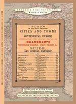
The Plans Of The Most Important Cities and Towns of Continental Europe 1896 by Bradshaw
Venditore: Feltrinelli24,99 € -
Wildfire Through Staffordshire
Venditore: Feltrinelli24,99 €


Informazioni sull’ordinamento
Vengono mostrati per primi i prodotti che rispondono a questi criteri: rilevanza rispetto alla ricerca, dati di venduto, disponibilità, data di pubblicazione, tipologia di prodotto, personalizzazione ad eccezione delle sponsorizzazioni.